Skill Level: All Divers, with caution
Current Sensitive: Yes. Use current tables for Admiralty Head: http://tide.arthroinfo.org/tideshow.cgi ... on+Current
Quoting Brandon Cole's recommendations: "Usually you’ll want to enter the water about 30 minutes before the predicted time for slack current. Don’t dive Keystone during a strong south or southeast wind, because the wind chop and surf break can be formidable."
The exposure to the straits and long fetch often make slack timing unpredictable.
Location/Address: Fort Casey State Park, Whidbey Island, WA
Directions: Driving from Seattle, take the Mukilteo Ferry to Whidbey Island. Drive 22 miles north on Highway 525, turn left to the Port Townsend Ferry and Fort Casey State Park, and drive 3.5 miles to Keystone. From Port Townsend, simply take the ferry to Whidbey Island and you're there.
Free Parking: Discovery Pass Required. $10/day or $30/year, as of 2017
Staging Area: Good -- Parking is near the water, with picnic tables for staging.
Surface Swim: Short.
Nearby Facilities: Washrooms and a shower on site. The nearest dive shops are in Oak Harbor Anacortes and Port Townsend.
Special Considerations: No underwater hunting or fishing in the conservation area.
Maximum Depth: 60ft, although much of the life is shallower.
Known Hazards: Strong currents are frequent here, and the ferry arrives on the other side of the jetty. Do not go 'around the corner' into the ferry lane!
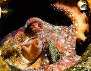
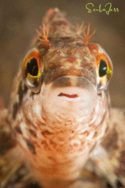
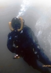
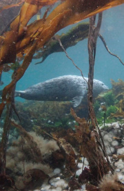
Dive Site Description: Dive along the east side of the spit and find a seemingly endless variety of life in the rocks. Wolf eels, octopus, nudibranchs, ling cod, rock fish, and many other species are commonly seen here. Be careful as you approach the end of the spit because the currents may be rippin', even during a supposed slack tide. Up the beach is an abandoned warf. It's shallower but also shelters an amazing array of critters. It's possible to drift from the warf to the jetty in a single dive, sometimes helped by a push from the current. There's a rope at ~45fsw that runs from the warf to the about the middle of the jetty, follow that. Keystone Jetty is indeed a crown jewel of Northwest diving.
Check out Brandon Cole's excellent article in Alert Diver.