Hi All,
Sharing this site i use to look at depths and underwater terrain before diving. It has very detailed information local and across the world. Great to reference when looking at new sites! Link below.
http://fishing-app.gpsnauticalcharts.co ... 1/-124.074
Water Depth Mapping Resource
Re: Water Depth Mapping Resource
Nice. It seems like the depths are from mean low tide (e.g. it shows Edmonds UW park as a max of 30 ft), but you can set an option to add an offset (+10 so 40ft)
Re: Water Depth Mapping Resource
Very interesting! I enjoyed looking at this!
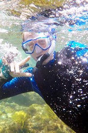
Visit pnwdiving.com for viz reports, slack planning, galleries and more! Your fellow diver will appreciate any viz reports you can add!
-
Jonny Quest

- Getting To Know Folks
- Posts: 7
- Joined: Fri Oct 04, 2019 10:54 am
Re: Water Depth Mapping Resource
If you havent already- I'd check out the mobile Navionics Boating app.
Check out ilovenudis.com
-
Cmjstealth
- Avid Diver
- Posts: 79
- Joined: Sat Jan 29, 2011 11:02 pm
Re: Water Depth Mapping Resource
Although there isn't full coverage across all the Puget Sound there is super high resolution bathymetry available thanks to the NOAA Hydrographic Survey: https://maps.ngdc.noaa.gov/viewers/bathymetry/
Selecting "BAG Color Shaded Relief" will show you the high resolution NOAA Hydrographic Survey stuff. Attached is an example near long island. "DEM Color Shaded Relief" will show data with much wider coverage but it unfortunately is much lower resolution. The color legends are viewable when you hover over the question mark icons. Unfortunately the scales are logarithmic but if you need a more specific depth estimate I've had success using a color picker tool in a graphics editors to measure the hue at a specific point and by comparing to a hue based color legend I made in excel. If others have an easier way I'd love to hear how you go about it.
Also... for fun turn off the DEM stuff and instead select "Multibeam Bathymetry Mosaic" which has data collected from various research vessels worldwide and zoom out to see just how little of the world's oceans have been explored. https://maps.ngdc.noaa.gov/viewers/iho_dcdb/ also has similar (or the same?) data available.
Re: Water Depth Mapping Resource
Cool, now I can guesstimate where it was that I clung to a rock/ramp for ten minutes, about 30 minutes into a "late slack" (aka too early start) :crabmode:Cmjstealth wrote: ↑Wed Sep 23, 2020 4:09 pm super high resolution bathymetry available thanks to the NOAA Hydrographic Survey: https://maps.ngdc.noaa.gov/viewers/bathymetry/