The Boss...Where the heck is it?

The Boss...Where the heck is it?
We've made a few unseccessful attempts to locate the old tug wreck in Blakely Harbor called The Boss. Does anyone have some good pointers on how to find it?
Did you use these coordinates?
http://home.comcast.net/~attblsmith/Scuba/mapframe.html
Running along the 40-45ft contour of the south shore should pick it up, its not very deep. I have been there once, honestly its not really worth a ton of effort to dive. I don't think its a tug, more a cabin cruiser like boat.
http://home.comcast.net/~attblsmith/Scuba/mapframe.html
Running along the 40-45ft contour of the south shore should pick it up, its not very deep. I have been there once, honestly its not really worth a ton of effort to dive. I don't think its a tug, more a cabin cruiser like boat.
-
Aquanautchuck

- Pelagic
- Posts: 919
- Joined: Thu Jun 01, 2006 4:33 pm
no, it was just a pile of rubble, nothing higher than a couple feet from the bottom, but pretty close to the same area that was listed here as the location of the boat...unless it has deteriated to a pile of rubble ](*,)
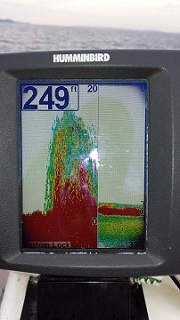
I've made 3 dives looking for it but none of us on our boat had ever been there before so as soon as we see the depth finder jump up 10' or so we move just beyond it and drop anchor. From what i hear it is in about 50' so we do a big circle looking for it but nothing yet. We found the rubble and a couple piles of boulders but no BOSS!
I must say though that i love nearby Blakely Harbor which is our usual destination so this is just a diversion that is driving me nuts because we can't seem to locat it.
no, it was just a pile of rubble, nothing higher than a couple feet from the bottom, but pretty close to the same area that was listed here as the location of the boat...unless it has deteriated to a pile of rubble ](*,)
I've made 3 dives looking for it but none of us on our boat had ever been there before so as soon as we see the depth finder jump up 10' or so we move just beyond it and drop anchor. From what i hear it is in about 50' so we do a big circle looking for it but nothing yet. We found the rubble and a couple piles of boulders but no BOSS!
I must say though that i love nearby Blakely Harbor which is our usual destination so this is just a diversion that is driving me nuts because we can't seem to locat it.
-
Sea of Green
Nice website! I didn't know about this one, lots of useful info. I was thinking of getting up to Seiku to do some shore diving in about a month during my vacation.CaptnJack wrote:Did you use these coordinates?
http://home.comcast.net/~attblsmith/Scuba/mapframe.html
That's EXACTLY where we've been looking for it...ARGH! Your coordinates are probably correct, we just haven't been able to locate it. We'll keep looking and let you know. ](*,)BlackToe wrote:I haven't dived the Boss in a couple years, but here are the coords I have in Google Earth for it:
47°35'22.40"N
122°29'17.76"W

Chev,
I'm prety sure I dove that about a year and a half ago with Teal Water dive charter. They referred to them as the blakely Harbor wrecks.
talking with Aquanaughtchuck I believe it was "The Boss" it had a bouy attached to it then. {Looking due east at the north point of Blakely Harbor and the red buoy that marks the dive site. The tide was high when this picture was taken. Depth is about 45 fsw at the buoy.}
http://www.seaotter.com/marine/html/blakely.html
It was an awsome dive, I saw the largest Ling there that I've seen to date.
For what it's worth thats my 2 cents
Hi, my name is Keith, and I'm a Dive Addict! 
That is the deep site at what has come to be known as "Norrander's Reef". Or on this map "Liker's Reef" it goes by various names.BASSMAN wrote:Chev,
I'm prety sure I dove that about a year and a half ago with Teal Water dive charter. They referred to them as the blakely Harbor wrecks.
talking with Aquanaughtchuck I believe it was "The Boss" it had a bouy attached to it then. {Looking due east at the north point of Blakely Harbor and the red buoy that marks the dive site. The tide was high when this picture was taken. Depth is about 45 fsw at the buoy.}
http://www.seaotter.com/marine/html/blakely.html
It was an awsome dive, I saw the largest Ling there that I've seen to date.
For what it's worth thats my 2 cents

The Boss is on the other (south) side of the harbor.
-
Aquanautchuck
- Pelagic
- Posts: 919
- Joined: Thu Jun 01, 2006 4:33 pm
Keith: I am sure the wreck I have been diving for many years is the Boss. The link to Blakely Harbor you provided looks a lot like the buoy that is on the West End of Blake Rock and marks the dive site I call China wall which runs East from there.
I have never taken my GPS up to get a bearing of the wreck. The Wreck that I dive looks like a old inter-island boat and about 5 years ago a old Chris Craft cabin cruiser sunk at the buoy and landed amid ship of the old wreck. The wreck I dive is at least 15' tall and about 50' long. And it has the biggest ling under the bow.
I have never taken my GPS up to get a bearing of the wreck. The Wreck that I dive looks like a old inter-island boat and about 5 years ago a old Chris Craft cabin cruiser sunk at the buoy and landed amid ship of the old wreck. The wreck I dive is at least 15' tall and about 50' long. And it has the biggest ling under the bow.
Charles
The buoy that use to mark the Boss isn't there anymore. It has made it a real pain to locate. We've made several trips and still no luck. The Bouy in the link above looks like a different site in the area. There are lots of great ones in Blakely Harbor but i would like to add the Boss to my dive log! ](*,)
I haven't tried Norrander's reef yet. How's that? Maybe i'll do a follow up there after our next faild Boss attempt
I haven't tried Norrander's reef yet. How's that? Maybe i'll do a follow up there after our next faild Boss attempt
Last edited by Chevayea on Wed Dec 26, 2007 4:33 pm, edited 1 time in total.
-
Aquanautchuck
- Pelagic
- Posts: 919
- Joined: Thu Jun 01, 2006 4:33 pm
To my knowledge the Fingers never have any substantive currents on them; we dive them as a 2nd dive of the day all the time. Ditto for the Boss (if the OP ever finds it, lol) and China Wall.
The "Fingers" (aka Norrander's, Liker's and Metridium wall) are basalt and are actually part of the Seattle Fault. They continued on and off through Blakely rock and eventually underneath downtown Seattle near the stadiums.
The pic shown is taken from somewhere above the fish farm in Rich Passage. I couldn't find a map view.
http://en.wikipedia.org/wiki/Seattle_Fault
The east side of Blakely Rock, a site we call "Shangrila" has some serious currents during both exchanges. But everywhere west of Blakely Rock is fairly benign.
I have about 30 dives in that general area. The latest was circumnavigating Blakely Rock on scooters. That was fun")
The "Fingers" (aka Norrander's, Liker's and Metridium wall) are basalt and are actually part of the Seattle Fault. They continued on and off through Blakely rock and eventually underneath downtown Seattle near the stadiums.
The pic shown is taken from somewhere above the fish farm in Rich Passage. I couldn't find a map view.
http://en.wikipedia.org/wiki/Seattle_Fault
The east side of Blakely Rock, a site we call "Shangrila" has some serious currents during both exchanges. But everywhere west of Blakely Rock is fairly benign.
I have about 30 dives in that general area. The latest was circumnavigating Blakely Rock on scooters. That was fun
-
Aquanautchuck
- Pelagic
- Posts: 919
- Joined: Thu Jun 01, 2006 4:33 pm
I knew that the East side of Blake rock had another name. Current has always been bad when I tried it. I have dove China Wall about 6 times and you can dive it most times since it is protected by the rock. But as you are diving and come to the East edge of the rock you can really feel the current. Just like diving Keystone with the current at the end of the Jetty.
Thanks for the info.
Thanks for the info.
Charles
I have many dives logged in the Blakely Harbor Reefs and there has never been any current to be concerned about, even when we have dove during extreme exchanges off slack. The surface has been a little tricky a couple of times but even that is rare.Aquanautchuck wrote:Hey Capt: I have wanted to dive the the fingers but I was warned that watch the currents. Maybe next time I do China Wall or the Boss I will scoot over to do them. Are the fingers clay or sandstone?
The rock is just like CapnJack said, stay to the inside (west) and your are pretty well shelteres. There is a bouy there right now. If you head too far east then it can pick up but it is a good indicator that it is time to head up the rock or turn back to the boat.
The Boss Buoy
The proprietors of the former dive charter service on Bainbridge Island maintained the buoy on the Wreck of the Boss because they delivered divers to it. Their business was mostly summer seasonal anyway, so they usually didn't keep the buoy in place during their off season.
They have since retired, so they may no longer choose to maintain a buoy there in the future.
They have since retired, so they may no longer choose to maintain a buoy there in the future.
Here are my coordinates:Chevayea wrote:That's EXACTLY where we've been looking for it...ARGH! Your coordinates are probably correct, we just haven't been able to locate it. We'll keep looking and let you know. ](*,)BlackToe wrote:I haven't dived the Boss in a couple years, but here are the coords I have in Google Earth for it:
47°35'22.40"N
122°29'17.76"W
47deg 35.463
122deg 29.771
Note these are degrees + decimal minutes (no seconds). Maybe these will get you on it. Although honestly its not worth days of effort to dive it.

We were out there on Saturday and the Aluminator has a buoy tied to the engine block of the smaller wreck on top of The Boss. You shouldn't have any trouble finding it with the buoy.CaptnJack wrote: Here are my coordinates:
47deg 35.463
122deg 29.771
Note these are degrees + decimal minutes
It's a smaller (~ 30') inboard pleasure craft that was sunk right on top of the boss. The rudder, engine, batteries, controls and lots of other items are still in place on the smaller vessel.CaptnJack wrote:Scott do you know what that other wreck is?
I didn't see a name or any other identification on the smaller boat.
There are also a couple of cabin cruisers sitting on the bottom in the same general area.